Tracing Ancient Tribal Cultures Through Historical Maps
The Human Side of Lines, Names, and Long Journeys
A Map Can Feel Like a Whisper From Another Time
There’s a particular feeling you get when you look at an old map for too long. At first, you’re just reading it—rivers, coastlines, mountain chains, strange spellings. Then something shifts. You start imagining the hands that drew it, the people who used it, the journeys it quietly witnessed.
A historical map of tribal cultures is never only about “where.”
It’s also about who, and how they lived, and why they moved.
Because long before modern states painted their borders in bold lines, people belonged to places in a different way. Their “territory” might have been the valley where they buried their ancestors, the river that fed their crops, the ridge that guided their seasonal migrations, or the trading path that kept the community alive.
So when we trace ancient tribal cultures through historical maps, we’re not just doing geography. We’re doing something closer to human archaeology: trying to see the world the way earlier societies experienced it—through memory, survival, and relationships.
Tribal Space Was Often Lived, Not Measured
Modern maps love precision. They want clear ownership: this side is mine, that side is yours. But many tribal cultures didn’t treat land as a cleanly fenced object.
Land was often understood as a living system:
- the place where your herds graze in spring
- the river bend where fish return every year
- the mountain pass that keeps you safe during conflict
- the grove where rituals happen, and nobody hunts
In a lot of societies, the “border” wasn’t a line. It was a shared understanding. Sometimes it was negotiated. Sometimes it was respected. Sometimes it was contested. But it didn’t exist as a fixed, permanent mark on the earth.
That’s why older maps can look confusing if we approach them with modern expectations. They might show zones rather than borders. They might name peoples rather than countries. They might emphasize routes, resources, or sacred places instead of administrative control.
And honestly, that makes them feel more human.
The Most Honest Tribal Maps Are About Movement
If you want to understand tribal history, don’t start by looking for where a group “ended.” Start by looking for where they moved.
Movement is not an exception in human history. It’s the baseline.
Communities moved for reasons that still feel familiar today:
- drought or colder winters
- scarce farmland or shrinking pasture
- conflict with neighbors
- political pressure
- new trade opportunities
- curiosity mixed with necessity
When historians map these migrations, the result isn’t a clean arrow from point A to point B. It’s usually a web: stops, returns, splits into branches, disappearances, reappearances under new names.
And those movements matter because migration does something powerful: it forces contact.
When groups travel, they meet others. They trade, compete, borrow, adapt. They pick up new words. They learn new techniques. They sometimes merge with other communities and become something new.
So a tribal map is often less like a portrait and more like a time-lapse.
Tribal Cultures Spread Like Smoke, Not Like Paint
Here’s a useful way to think about it:
A modern empire spreads like paint—you can color a whole region and say “this is ours.”
Tribal influence often spreads like smoke—it drifts, it settles in some places, it thins out in others, it mixes with the air already there.
That’s why the map of tribal cultures is rarely a set of neat blocks. You get overlaps. Shared zones. Mixed identities. Regions where one language dominates but rituals are borrowed. Places where names change but customs remain.
This can feel frustrating if you want certainty. Yet it’s one of the most truthful things we can learn from ancient mapping: culture is rarely pure, and it almost never stays still.
Indigenous Maps in the Americas: A Different Kind of Geography
One of the easiest ways to understand how “cultural mapping” differs from “political mapping” is to look at Indigenous mapping traditions in the Americas.
Many Indigenous communities did map their world, but not always in a way that resembles modern atlases. Some maps were visual, some were woven into objects, some were performed through storytelling. Often the goal was not to establish borders but to preserve knowledge.
These mapping traditions might highlight:
- waterways as travel arteries
- seasonal hunting routes
- sacred landmarks
- alliances and intertribal relationships
- ecological knowledge tied to specific areas
In other words, they mapped meaning, not just measurement.
European cartographers often misunderstood these systems. They expected maps to behave like legal documents. Many Indigenous maps behaved more like memory tools—guides for living in the land, not owning it.
Medieval Europe: When Tribes Became “Names on Paper”
In medieval Europe, many maps and chronicles began to name tribes and peoples across regions, partly to explain where kingdoms came from and why languages differed.
Those maps didn’t always represent reality in a precise way. Sometimes they labeled an area with a tribal name that had historical prestige even if populations had shifted long before. But even when imperfect, these maps reveal something important: a growing awareness that identity has a history.
A tribal name on a medieval map often represents layers of time:
- older settlement
- later displacement
- cultural influence lingering in language or customs
- political claims built on ancient ancestry
In that sense, these maps are less like snapshots and more like arguments about origin—attempts to explain who belongs where, and why.
Indo-European Migrations: A Map That Explains Why Languages “Rhyme”
The Indo-European migrations are frequently mapped because they help explain one of the strangest facts in history: languages separated by thousands of kilometers still share deep similarities.
When scholars place linguistic evidence beside archaeological findings, they see patterns that suggest large movements of peoples from the Pontic-Caspian steppe, spreading over time into Europe and parts of Asia.
Even with ongoing debates about details, the broad idea remains powerful: migration doesn’t just move bodies. It moves words, habits, technologies, social structures, and stories.
A map of these movements is not simply about “tribes traveling.” It’s a clue to why modern societies, far apart today, still share echoes in vocabulary, mythology, and cultural structure.
That’s why these maps feel alive: they explain the present through the past.
The Land Still Carries Tribal Memory—Quietly
Even when tribal groups transform or disappear as distinct political units, traces of them often remain. Not always in monuments. Sometimes in the most ordinary thing: a name.
Place names are like fossils of language.
A river name might preserve an older tongue. A town name might carry a tribal identity long after the tribe itself merged into another population. In the American Southwest, many names still carry Indigenous roots that survive centuries of change.
When historians map place names next to older tribal distributions, they sometimes see startling continuities. You realize the landscape itself has memory. It keeps certain words, even when everything else changes.
Why Mapping Can Be a Form of Cultural Repair
In many places today, mapping is no longer just academic work. It has become part of cultural survival.
Modern Indigenous mapping projects often combine:
- oral histories
- ancestral place names
- sacred sites and cultural landmarks
- ecological knowledge transmitted over generations
- digital tools (GIS, interactive maps, archives)
These projects do something deeply human: they restore visibility. They say, “We were here, we are here, and our story belongs to this land.”
That makes maps feel less like cold documents and more like acts of recognition.
A Better Way to Read Tribal Maps (Without Forcing Them to Behave Like Modern Ones)
Next time you look at a historical map of tribal cultures, try this approach:
- Look for routes first (rivers, coasts, valleys). Those are the natural highways.
- Look for resources (fertile plains, metal-rich zones, water sources). Those explain pressure and conflict.
- Look for meeting points (ports, passes, river mouths). That’s where cultures blend.
- Treat borders as guesses, and treat overlap as real.
This method makes the map instantly more understandable. It stops being a confusing patchwork and becomes what it truly is: evidence of human life responding to geography.
Closing Thought: Maps Don’t Only Show Where People Lived. They Show How People Endured.
When you trace ancient tribal cultures through historical maps, you start noticing that history isn’t made only by kings, capitals, and wars. It’s also made by decisions that never get written down:
- when a community chooses to move instead of fight
- when two groups trade instead of raid
- when a language absorbs foreign words because commerce demands it
- when a sacred place stays sacred even after the people change
Those choices shape maps in ways borders never fully explain.
And that’s why these maps matter. They remind us that human history is not a set of fixed territories. It’s a long, complicated, deeply human story of movement, adaptation, and belonging—written across landscapes, one generation at a time.
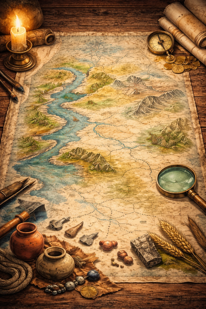
Ancient Tribal Cultures Through Historical Maps
A human way to read old maps: not as strict borders, but as lived landscapes—routes, meeting points, sacred places, and the quiet trails of migration that shaped languages and identities.
- Look for routes before borders
- Spot meeting points (ports, passes, river mouths)
- Track resources (water, pasture, metals)
- Expect overlap and hybrid zones
Why Historical Maps Feel Different
Modern maps answer a legal question: who controls what. Many historical and tribal maps answer a human question: who moves where, who meets whom, and what places matter enough to remember. That is why they often highlight rivers, grazing corridors, sacred landmarks, and trade paths instead of hard lines.
How to Read Ancient Tribal Cultures on a Map
Rivers, coasts, and valleys guide movement. If a map shows repeated settlement along a river system or coastline, you are looking at a cultural corridor where contact becomes routine.
Ports, mountain passes, river mouths, and fertile crossroads create repeated encounters. These areas often produce bilingual zones, blended art styles, and shared rituals.
Water, pasture, metal deposits, and farmland explain why groups migrate, negotiate, or fight. Resource maps often predict tribal movement better than political labels.
Many tribal territories overlapped by season or agreement. On a map, “fuzzy edges” are not errors—they are often the truth: shared hunting grounds, trade partnerships, and shifting alliances.
Quick Table: What Tribal Maps Often Reveal
This is a practical cheat sheet. It helps you interpret what a map is implying, even when the “borders” look unclear.
| Map Feature | Symbol | What It Usually Means | Human Example |
|---|---|---|---|
| River corridors | 🌊 | Migration routes, settlement chains, trade movement | Communities relocating along water during drought cycles |
| Mountain passes | ⛰️ | Chokepoints: exchange, tension, alliances | Caravans meeting, taxes/tribute, guarded routes |
| Fertile belts | 🌾 | Dense settlement, stable communities, competition | Rival groups negotiating grazing rights at harvest time |
| Sacred sites | 🕯️ | Shared identity, rituals, memory landmarks | Pilgrimage routes linking clans across seasons |
| Artifact distribution | 🏺 | Contact and diffusion across distance | Same pottery style appears along multiple coastal markets |
| Place-name clusters | 📍 | Long memory of language and identity | Ancient tribal roots preserved in modern town names |
| Tip: If the map looks “messy,” that often means it’s honest. Overlap usually reflects seasonal movement, trade partnerships, and mixed communities. | |||
FAQ
Why do tribal “borders” look unclear on many historical maps?
What evidence do historians use to place tribes on maps?
How can modern digital maps help cultural preservation?
Read more
- indigenous heritage catalog
- cultural migration patterns
- tribal maps in modern use